The Last Fishing Grounds: Can Kenya Protect Coastal Communities from a Blue Economy Boom?
In a conference room overlooking Kenya's Indian Ocean coastline, a lawyer representing a marine conservation organization raises her hand.
The discussion is technical. Participants are reviewing hundreds of pages of Kenya's proposed Marine Spatial Plan, a blueprint that will guide how the country's ocean space is used until 2045.
But beneath the policy language and zoning maps lies a fundamental question.

Who gets access to the sea?
The question dominated discussions during a stakeholder validation forum held at the headquarters of the Kenya Marine and Fisheries Research Institute (KMFRI) in Mombasa. The meeting brought together environmental organizations, community advocates, legal experts, fisheries stakeholders, conservation groups and Blue Economy practitioners to scrutinize Kenya's most ambitious ocean governance initiative.
Leading the discussion was planning consultant Titus Musungu of Geodev Kenya Ltd, one of the experts guiding the development of the Marine Spatial Plan.
As participants challenged assumptions, proposed amendments and highlighted potential risks, Musungu repeatedly encouraged them to go deeper.
"You may be the person that makes the difference between a good plan and a bad plan," he told participants, urging them to conduct a detailed, "blow-by-blow assessment" of the draft document.
It was a statement that reflected the significance of the moment.
Kenya is attempting to plan the future of its ocean before conflicts over marine space become unmanageable.
The blue economy dilemma
Across the world, governments are racing to unlock the economic potential of oceans.
Known as the Blue Economy, the concept promises jobs, investment, food security and climate resilience through sectors such as fisheries, tourism, shipping, renewable energy, aquaculture and marine biotechnology.
Kenya has embraced the vision enthusiastically.
Yet every new investment in the ocean creates pressure on existing users.
A marine protected area may limit access for fishers.
A shipping corridor may overlap with traditional fishing routes.
An undersea cable can intersect with migratory pathways used by marine wildlife.
A tourism development can alter community access to beaches and landing sites.
These competing interests are becoming increasingly common along Kenya's 640-kilometre coastline.
The Marine Spatial Plan seeks to reduce these conflicts by mapping different ocean uses and establishing rules for how activities can coexist.
But for many coastal communities, the concern is not simply about maps.
It is about survival.
A sea of competing interests

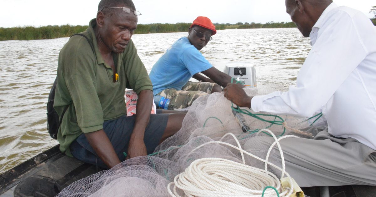
For generations, artisanal fishers have relied on nearshore waters for food and income.
Their boats are small. Their fishing grounds are local. Their dependence on healthy marine ecosystems is absolute.
Yet these communities often possess the least political and financial influence when major developments occur.
Throughout the MSP consultations, community organizations, NGOs and Beach Management Units repeatedly raised concerns about protecting traditional fishing grounds and safeguarding community access to marine resources.
The stakeholder response matrix developed during the planning process reflects these concerns.
Participants called for stronger protection of fishing areas, improved fisheries management, safeguards against displacement and greater inclusion of vulnerable and marginalized groups in decision-making.
One recommendation accepted into the planning framework emphasizes that zoning should avoid involuntary displacement of traditional users unless required by law, safety or ecological necessity and supported by consultation and livelihood safeguards.
The provision may appear technical.
For fishing communities, it could prove transformative.
Beyond conservation versus development
One of the most striking aspects of the Mombasa discussions was the recognition that marine conflicts are no longer limited to conservation versus development.
They are becoming increasingly complex.
Participants highlighted the need to incorporate international environmental treaties, fisheries regulations, maritime transport laws, climate legislation, mining regulations and emerging global agreements governing biodiversity beyond national jurisdiction.
A legal expert from a marine conservation organization urged planners to strengthen the policy framework by including conventions on migratory species, endangered species protection and the recently adopted Biodiversity Beyond National Jurisdiction agreement.
The concern was clear.
Activities occurring far beyond Kenya's territorial waters could still affect ecosystems and livelihoods within Kenyan waters.
Ocean governance can no longer stop at national borders.
Human versus human. Human versus nature.
At one point during the session, a participant asked whether the plan adequately identifies areas where future conflicts are likely to emerge.
The response from Musungu revealed the broader philosophy behind the planning process.
"The conflicts that we are dealing with are two types inside the document," he explained.
"We are dealing with human-human conflict in the use of ocean space and we are also dealing with human-nature conflicts in the use of ocean space."
It was perhaps the most important statement of the day.
Marine spatial planning is often portrayed as a technical exercise involving maps and zoning.
In reality, it is an attempt to manage relationships.
Relationships between fishers and tourism operators.
Between conservation objectives and local livelihoods.
Between economic growth and ecological limits.
Between present needs and future generations.
The conflict hotspots identified within the plan are therefore not simply geographical locations.
They are places where competing visions for the future collide.
The growing importance of local voices
Historically, many marine management decisions have been made by government agencies, scientists and policymakers.
The MSP process is attempting to broaden participation.
The stakeholder matrix shows repeated calls for greater inclusion of women, youth, vulnerable and marginalized groups, tourism actors, cultural custodians and small-scale operators.
Participants also advocated for expanded public engagement through local languages, community workshops, radio broadcasts and digital platforms.
The message was consistent.
Marine planning cannot succeed if coastal communities feel excluded.
As one participant noted during discussions, even the most scientifically sound plan can fail if it lacks social legitimacy.
That concern is particularly relevant along Kenya's coast, where communities have sometimes viewed conservation initiatives and development projects as externally imposed.
The MSP process represents an opportunity to change that narrative.
Climate change raises the stakes
Adding urgency to the discussion is climate change.
Sea-level rise, coastal erosion, coral bleaching, declining fish stocks and increasingly unpredictable weather patterns are already affecting coastal livelihoods.
Many stakeholders argued that future planning decisions must account for these realities.
Protecting fishing grounds is no longer simply an economic issue.
It is a climate adaptation strategy.
Healthy mangroves protect shorelines from erosion.
Coral reefs support fisheries and tourism.
Seagrass beds store carbon while providing nursery habitats for fish.
The fate of coastal communities is increasingly tied to the health of these ecosystems.
What happens next?
The validation process represents one of the final stages before Kenya's Marine Spatial Plan proceeds toward adoption and implementation.
Not every issue has been resolved.
Questions remain around governance, enforcement, dispute resolution, financing and institutional coordination.
Yet the atmosphere in Mombasa suggested a growing consensus that doing nothing is no longer an option.
Kenya's ocean is becoming busier.
More valuable.
More contested.
And more vulnerable.
The challenge facing policymakers is not whether development should occur.
It is determining how that development can proceed without sacrificing the communities and ecosystems that have sustained coastal life for centuries.
The answer may ultimately determine whether Kenya's Blue Economy becomes a model for sustainable ocean governance or another example of economic growth leaving traditional communities behind.
For now, the maps are still being debated.
The boundaries are still being refined.
And the future of Kenya's ocean remains, quite literally, a work in progress.